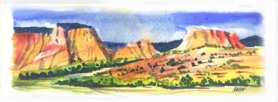
Kolob Terrace is remote, but a beautiful place to visit

Sweeping from the 10,000 foot heights of the Markagunt Plateau in southwestern Utah to the cliff tops of Zion Canyon, swaths of evergreen forests, stands of stately aspen, wide flower-strewn meadows and thickets of scrub oak cloak the gorgeous Kolob Terrace. Visitors find access to this wild and rugged area limited to several foot trails, a few primitive tracks and one mostly paved route open when snow recedes.
The Kolob Terrace Road runs nearly 50 miles from near Cedar City on Highway 14 to the town of Virgin on Highway 9 on the approach to the main entrance to Zion National Park. The lower half of the road as far as Kolob Reservoir remains open longer to provide access to several trailheads exploring remote reaches and canyons in the park.
During summer, access this scenic route from either end, but keep in mind the steady climb from south to north. Drive slowly enough to enjoy the scenery. Start out with a full gasoline tank, extra water and a good spare tire. Big motor homes and vehicles towing longer trailers may experience difficulty negotiating narrow, winding sections of the road. Pavement gives way to a good gravel surface for a few miles north of Kolob Reservoir.
To reach the Kolob Terrace Road from the north, follow Interstate 15 north to Cedar City, about 170 miles from Las Vegas. Exit there to find the Highway 14 junction downtown. Head east into beautiful Cedar Canyon a few miles until you spot the Kolob Terrace Road sign. If you pass Milt’s Stage Stop Steakhouse, you have gone too far. The turnoff, not marked if you are coming down from the Cedar Breaks or Navajo Lake area, lies a mile west of Milt’s.
The road begins a series of swooping zigzags out of the canyon. Panoramic views from this edge of the Great Basin extend over Cedar City into the faded purple distances of Nevada. The road climbs forested slopes where fine homes on view lots pop up like mushrooms after a rain. It tops out on the shoulders of 9,100-foot Lone Tree Mountain for the first views over the Kolob Terrace. A rugged line of pink cliffs marks distant Strawberry Point and other parts of the eroded rim of the high plateau.
Soon miles of zigzag fences of tree trunks delineate the road. Summer homes dot some of the forested areas. Tall quaking aspens shading the road promise gorgeous color displays next fall. Horse and cattle graze in wide meadows bright with wild flowers. Sheep on summer pasture mass on hillsides, their herders camped in a stand of trees nearby. Bring your camera for the photo ops around every turn along this road.
Kolob Reservoir attracts anglers vying for record trout, despite the limit of one trout and no bait. Fly fishermen try their luck for lunkers from points along the road encircling the lake and from boats in the middle. Anglers need Utah fishing licenses. Although development remains limited, people do camp there in RVs. Plan to bring everything from home and use camp stoves only. Dry conditions dictate no open fires.
Blue Springs Reservoir, a smaller body of water, lies a couple of miles south of Kolob Reservoir. Turn there on a dirt road to reach Lava Point which overlooks Zion’s upper canyons. A sign warns against attempting this short road in a vehicle longer than 19 feet. Six primitive campsites nestle among tall evergreens in this no-fee out post within the national park. Bring water.
Visitors to Lava Point report recent sightings of soaring California condors for the first time in decades. Once nearly extinct, the huge birds probably descend from several carefully transplanted some years ago to the cliffs above the Colorado River and east of the Grand Canyon, no great distance for a condor.
The road soon enters a spectacular region of colorful sandstone atop steep canyons cut by numerous small creeks. It drops quickly from the cliff tops as it follows one of these creeks to reach the Virgin River at the town of Virgin. Follow Highway 9 through Hurricane or turn at Toquerville to return to I-15.
Margo Bartlett Pesek’s column appears on Sundays.