Lots of scenery, history along byway in Utah

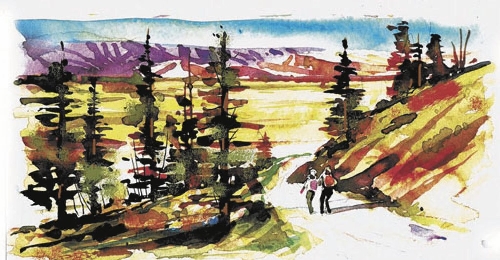
Short, but spectacular, the 9-mile Smithsonian Butte Scenic Byway in southwestern Utah near Zion National Park remains a little-known gem. Used primarily by locals as a shortcut, the graded road links Highway 9, the main route into Zion, with Highway 59, the road from Hurricane across the Arizona Strip toward Kanab, Lake Powell, Grand Canyon’s North Rim and other attractions.
To reach the byway from Las Vegas, head north on Interstate 15 into Utah through St. George. North of St. George, watch for the exit toward Hurricane on Highway 9. Continuing on Highway 9 through Hurricane takes you along the Virgin River to approach the byway from the north in Rockville. You approach the byway from the south if you turn on Highway 59 in Hurricane and drive about 11 miles to Big Plain Junction and then turn north.
Following this back road reveals glimpses of frontier history and splendid scenery. It offers panoramic looks into Zion Canyon, the best views of some of Zion’s towering formations and calendar scenes of striated Canaan Mountain rising above the aptly named Vermilion Cliffs. Smithsonian Butte, a 7,000-foot geological feature at the western end of the cliffs, was named by explorer John Wesley Powell when he led expeditions into the area in the late 1860s and early 1870s. Powell gained fame as the leader of the first group to course the Colorado River through its fearsome canyons using wooden boats in 1869.
The byway crosses the Virgin River at Rockville on a narrow steel bridge. A little more than a mile across the river, a road forks to the right. This leads to the remains of Grafton, a frontier farming town established by Mormon colonists. Stop at its little cemetery to read headstones that tell stories of pioneer deaths by disease, disaster and massacre. The fence around a mass grave marker is a recent restoration. The road ends at Grafton, where several buildings still stand.
In 1859, several families settled on the southern bank of the Virgin River to establish farms, build homes and raise cotton, among other crops. The river soon wiped them out. Determined, they moved a mile upriver and rebuilt on higher ground. This settlement and several others in the vicinity disrupted the lives of the native people established there. By 1865, Indian troubles began in isolated places. The mass grave in the cemetery marks the massacre of a young man, his wife and his brother. Mormon leaders ordered the pioneers to group together for safety. Families from Grafton moved across the river to larger communities in 1866 but returned in 1868 when treaties settled the conflicts.
Visitors today see a two-story school building also used as a church and community center, three family homes, a couple of barns, a raised granary and an original split-rail fence. A nonprofit interested in preserving Grafton oversaw several restoration projects. Renovation stabilized the 1886 adobe school and the oldest house in town, an 1862 adobe home next door. That home was occupied by members of the same family until 1944. Private owners restored the other houses and outbuildings, most dating from the 1870s. The group nominated Grafton and surrounding features for a national listing of historic sites as a historical district, a designation not yet finalized.
If Grafton looks familiar, it might be from the movies. Hollywood discovered Grafton as a location first in 1929 with the Cisco Kid in “Old Arizona,” the first “talkie” in color. “Ramrod” with Joel McCrae followed in 1947. The most famous film using Grafton for key scenes was “Butch Cassidy and the Sundance Kid,” starring Robert Redford and Paul Newman. The notoriety made the Grafton Schoolhouse one of the most photographed buildings in Utah. The appeal for filmmakers is obvious to visitors, for Grafton has 19th-century charm and Zion’s gorgeous scenery as background.
Retrace the road to the fork to continue on the byway. The drive may be made in passenger vehicles. Just slow down on bumpy portions, and don’t attempt the drive after a heavy rain. Follow the twisting route from the river valley to higher country cloaked with pinions and junipers. Allow time to pull over for unmatched views of vividly colored landscapes under skies made bluer by contrast. At Highway 59 turn right for Hurricane or left for Pipe Spring National Monument, a frontier fort.
Margo Bartlett Pesek’s column appears on Sundays.