Deborah Wall: Hidden Forest trail gets cooler as you go


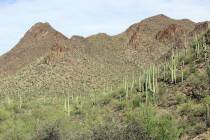
Hidden Forest can be the destination for a wonderful 10-mile, round-trip day hike, or for a backpack excursion up to a rustic cabin in a ponderosa pine forest. Though the trailhead lies within 50 miles of Las Vegas, its 5,860-foot elevation provides a welcome escape from the searing summers of the valley floor. It gets even cooler as you go, for the hike has an elevation gain of about 2,000 feet. The gain is spread pretty evenly through the journey, but it’s moderately strenuous even so.
From the trailhead, head up the broad wash and onto an abandoned road. Here you will be in a blackbrush plant community with some small yuccas and Joshua trees. Farther up the trail you will see single-leaf pinyon pine, Utah juniper and sagebrush. After about 4 miles you will find yourself in a quiet and shady forest, walking among ponderosa and white fir trees.
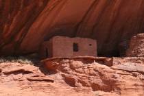
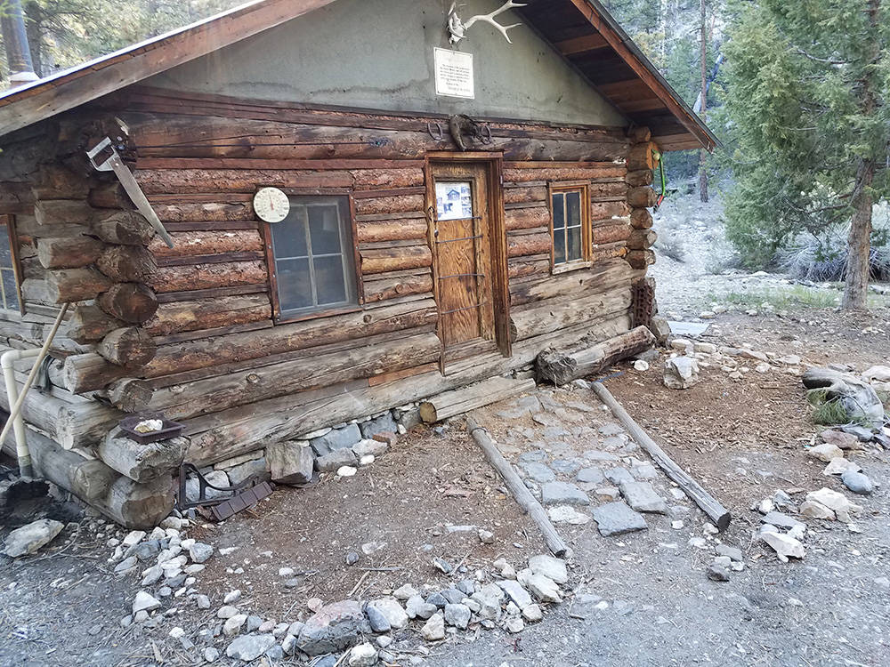
Along the first mile the road surface is loose gravel until you reach Deadman’s Canyon. A bout 5 miles from the trailhead you will see the cabin up on a slight rise at the mouth of an unnamed canyon. The cabin is on the National Register of Historic Places, yet the details of its origin are vague. It was built from hand-hewn wood, most likely by a cattleman or miner in the late 19th century. It is also thought to have been used by moonshiners during Prohibition.
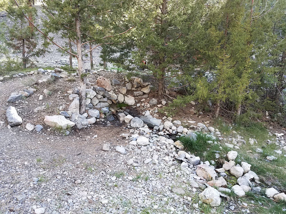
About 250 yards north of the cabin you will find Wiregrass Spring. The water here is unreliable, so don’t count on using it. Carry all the water you expect to need for this trip, and some more. If you find yourself needing the spring water and there happens to be a good flow when you need it, be sure to treat it before drinking.
The cabin is stocked with lots of pots and pans, a variety of tools and some emergency supplies. It’s rather charming and some people choose to sleep overnight there, but be aware that it is available on a first-come, first-served basis, so there may be “no vacancy.” Furthermore, rodents and other small animals like to live in the cabin, so if the weather is good, I prefer and recommend dispersed camping outside, but near the cabin. That’s allowed, except near the spring. There is a rustic toilet behind a ponderosa tree, just south of the cabin.
Incidentally, the Air Force has proposed closing this area to public use so it can expand the Nevada Test and Training Range. Outdoor interest groups have objected, and it won’t happen, if at all, for a few years. But the window of opportunity to visit Hidden Forest may not remain open indefinitely.
I suggest you attempt the drive to the trailhead only in a four-wheel- or all-wheel-drive vehicle with high clearance and good off-road tires. Conditions on the Alamo Road can be hazardous and unpredictable, especially during and after monsoonal weather. Storms come in very fast and furious in this area, mostly from the Mount Charleston area of the Spring Mountains. There are powdery road surfaces in some areas, where vehicles raise dust that is unpleasant and even unhealthy to breathe. Do not rely on cellphones getting reception here.
Although the trailhead is not far from Las Vegas, driving there will take a little longer than one might expect, because the final 18 miles or so is on gravel. Nevertheless, allow yourself time to stop at the range’s Corn Creek Visitor Center. They have maps there, and rangers can give you the heads-up on road conditions, fire restrictions and possible incoming weather. If the visitor center is not open, sign in at the self-registration box so they’ll know where to look if you get stranded.
Deborah Wall’s book “Base Camp Las Vegas: 101 hikes in the Southwest” ($24.95, Imbrifex) is available on Amazon. She can be reached at deborabus@aol.com.
Directions
From Las Vegas, go north on U.S. Highway 95 about 26 miles. Head right onto the paved Corn Creek Road for 3.7 miles to the Corn Creek Visitor Center. Stop for any available information. Leaving the visitor center, go left on the gravel Alamo Road and drive about 15 miles to Hidden Forest Road. Go right and drive 3.6 miles to the parking area and signed trailhead.
More information
For information about Hidden Forest and Corn Creek Visitor Center hours, call 702-879-6110 or go to fws.gov/refuge/desert.