McCullough Hills Trail ideal for when sun isn’t bearing down

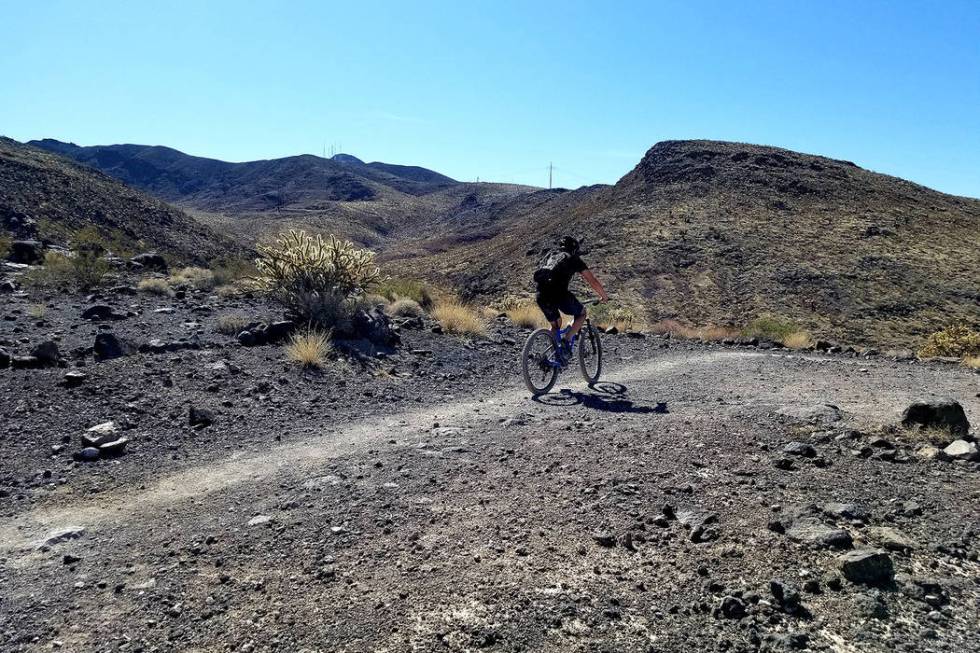
Walkabouts in Henderson’s outback can help strengthen the heart and clear the cluttered mind. Quiet trails wind through protected land that’s just on the other side of hills dotted with multimillion-dollar mansions. One of those paths, McCullough Hills Trail, allows hikers, runners and mountain bikers to traverse 8 miles of Sloan Canyon National Conservation Area.
Hiking this marked trail is moderately difficult, mostly because of its length and the demands of a half-day commitment. After the first mile up from our starting point at Anthem Hills Park, it wasn’t overly challenging in terms of elevation gain (600 feet) or terrain. On an early fall day, we chose the west-to-east direction, although a second option could have been the reverse — starting at McCullough Hills Trailhead and heading west to Anthem Hills Park. Next time, we plan to start at McCullough Hills Trailhead, at 295 Mission Drive in the general area of Horizon Drive and U.S. Highway 95. From there, we’ll head in the opposite direction, east to west. Either way represents an 8-mile commitment, but we chose west-to-east this time because we had our eyes on the prize of an early Thai dinner at Naga restaurant after our hike.
Two cars were part of our hiking equation. We left one at McCullough Hills Trailhead, and my husband and I then took our other car to the starting point at Anthem Hills Park, where it would remain for most of the day until we drove back much later to get it. In the Anthem Hills parking lot, we followed signs to the trailhead and parked near the baseball fields.
As we took to the trail, our backpacks were heavy with water, snacks and an all-important second set of keys, so we could start the second car we had left 8 miles away at the end of our route.
For the hike’s first mile, power-walking pairs of friends chatted as they accomplished their morning cardio goals. Runners whizzed past. Dogs walked their owners. The farther into the hike, the fewer people we encountered.
Our hike actually began on Anthem East Trail and led uphill through a tapestry of beige with creosote, white bursage and not much other vegetation. When stunning panoramas of the Las Vegas Valley come into view, it was time to search for trail signs with the image of a Gila monster, the black-and-orange stripy unicorn of the Mojave Desert (no, unfortunately, we did not see this poisonous lizard on our hike). Before we found the Gila monster signs, we accidentally added mileage and more stunning views to our journey by mistakenly taking the Bursage Loop. Extra unofficial trails in the area created some confusion before we discovered signs that assured us we were on the official McCullough Hills Trail. After that, we saw a Gila monster sign every mile until we reached trail’s end.
It’s best to study a map before stepping onto the trail, but the routes in Sloan Canyon can remain confusing. Here’s an important link to help with planning and visualizing: on.doi.gov/349Zjtd.
Within the first 2 miles of McCullough Hills Trail, there are separate paths for hikers and horses, and that caused us some mild second-guessing. We spent some time on the power line road and horse trail, but we got back on the hiking trail and remained confident we were headed in the right direction because the well-worn path led east. More assurance came from another sun-baked mile marker with the trail’s spirit animal, the Gila monster. Occasionally, there was also encouragement from other walkers, runners and bicyclists.
But much of the experience is solitary in the outback of rolling hills and blue skies just on the other side of the ridge line from upscale homes in MacDonald Highlands and Dragon Ridge neighborhoods. The contrasting quiet and rugged beauty are remarkable in Sloan Canyon National Conservation Area.
Few critters were out and about during our hike, but a friend we spotted running along the trail told us to be on the lookout because he had just seen two bighorn sheep. As we neared the end of the trail, we spied ravens and robins. Along the way we saw Mojave yucca and a few Joshua trees as well as cholla and barrel cactus. The geology became more interesting during the last third of the trail because the River Mountains came into view, and a trailside strip of exposed red rock looked like the plates along a stegosaurus’s spine.
McCullough Hills Trail only has two shade structures, making it one of the last places I’d want to be in the summer. But the sun’s warmth was welcome on a cool fall day. We rested on benches at both shade structures, the first of which offered an unexpected mountain-framed peek of The Strat and the Drew Las Vegas, where construction is not yet finished. Near the end, part of the experience is a panorama of Henderson’s eastern edge and its southern tip reaching toward Boulder City.
McCullough Hills Trail is a mostly gentle hike with a few steep climbs, switchbacks and arroyo crossings. Our 4½-hour hike was good exercise in a peaceful, wide-open space where paths had been carved to make our adventure enjoyable. Watching where my feet fell in unfamiliar territory always gives my mind a healthy focus and mutes the noise of worry.
After completing this trail, you may feel like a singha, which means mythical “lion” in Thailand, or a Singha, the name of a popular Thai beer. Because this hike had been on our wish list for a couple of years, we felt like both and stopped off at Naga before retrieving our second car.
Natalie Burt, a former news reporter at the Review-Journal for 11 years, spends as much of her free time as possible enjoying Southern Nevada’s outdoors. She’s now a teacher and has lived in Henderson for 18 years. Email: nvburt@gmail.com.