Valley of Fire, Bowl of Fire both perfect for fall excursions
Southern Nevada’s favorable fall weather translates into good times in outdoor spaces that have fire in their names. Valley of Fire State Park and Lake Mead’s Bowl of Fire are two spots worth visiting on these cooler days.
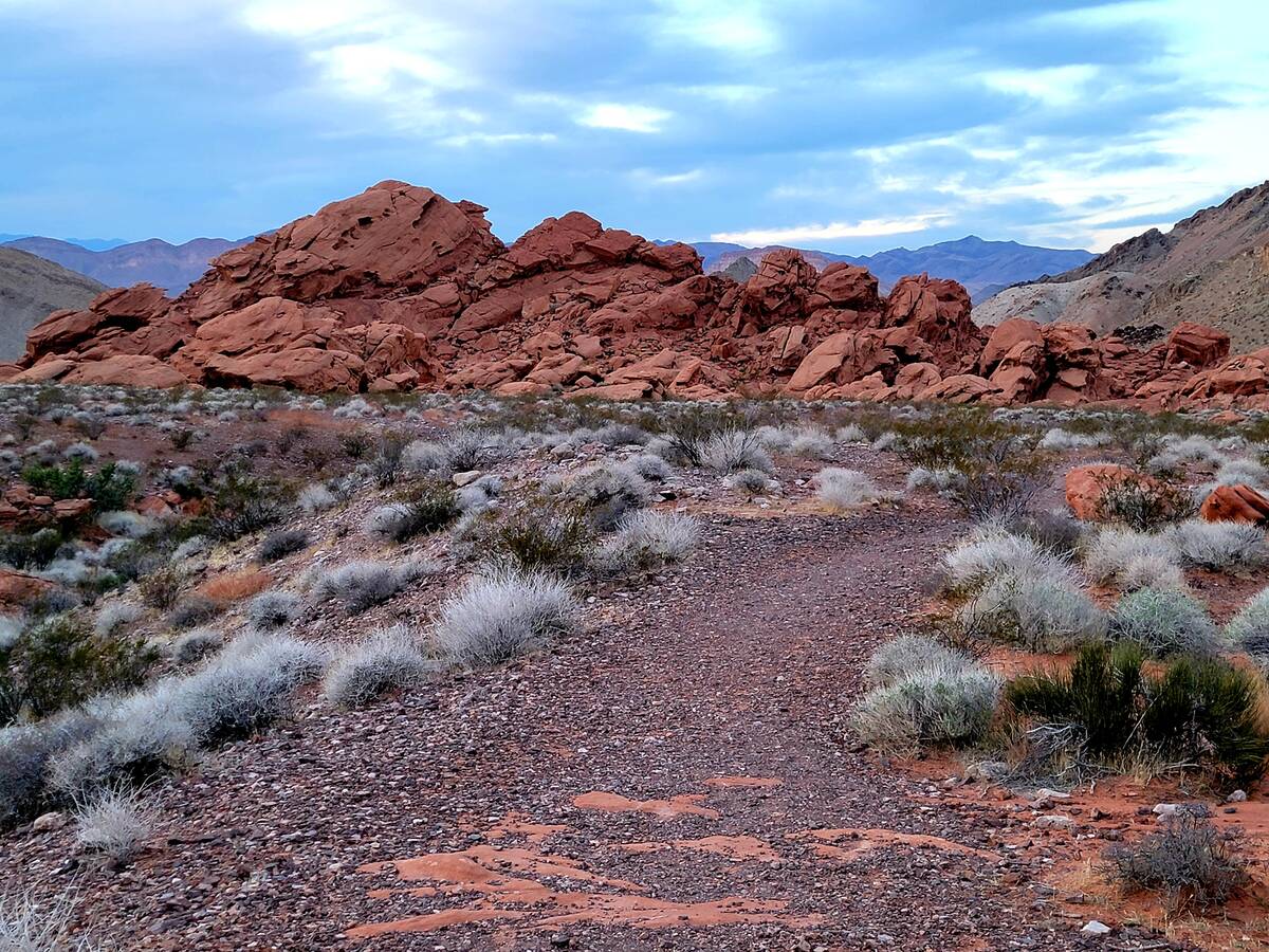
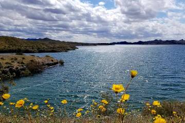
Vibrant and geologically stunning red rock formations are clustered in the state park about an hour north of Las Vegas, and along the far reaches of Northshore Road in Lake Mead National Recreation Area. In the months of May through September, sizzling temperatures can make both areas dangerous for those who want to roam around and soak in the scenery. The rocks retain heat like cast-iron cookware, and shade is rare. By contrast, precious days without winds too strong or temperatures too low in November through February are ideal for planning short or long hikes and simple or elaborate picnics.
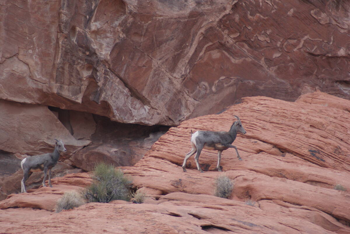
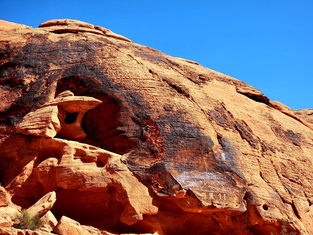
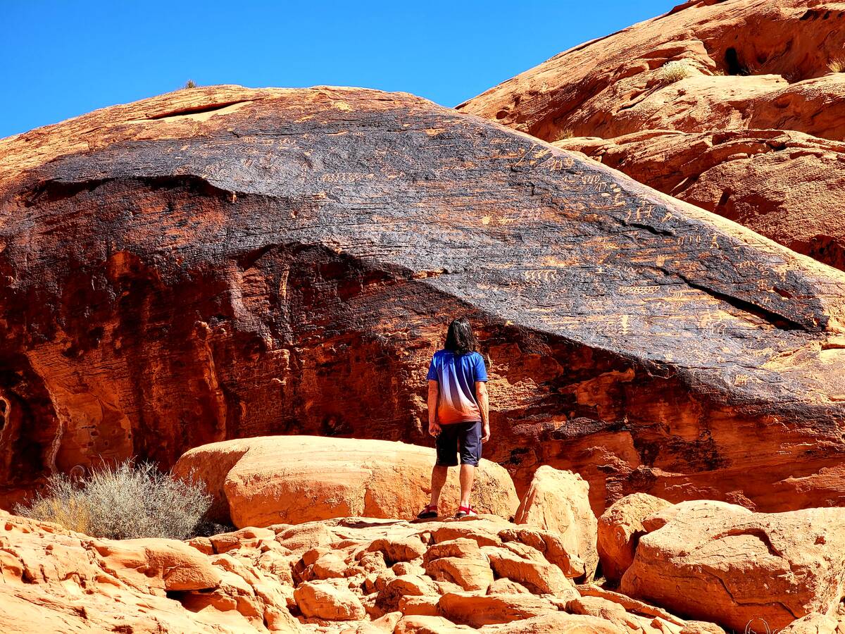
For many Nevadans, Valley of Fire is where they spot their first desert bighorn sheep and petroglyph panels. Although nature offers no guarantees, Valley of Fire is among the most reliable locations in Southern Nevada to witness the official state animal climbing and foraging in the wild. And prehistoric petroglyphs come into view within minutes of stepping foot on Mouse’s Tank Trail during a visit to Nevada’s first state park.
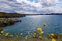
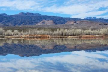
Reds and oranges of Lake Mead’s massive Bowl of Fire peek above the grays and browns along Northshore Road as the scenic drive stretches nearly 50 miles toward state Highway 169, just a short distance from the eastern entrance to Valley of Fire State Park and one of its most whimsical formations — Elephant Rock. On its reach from near the national recreation area’s Lake Mead Parkway entrance station to the general area of Valley of Fire, Northshore Road grants motorists splendid and varied views of geologic formations that hold stories of volcanic violence, sand dunes petrified after dinosaur times and some dramatic uplifting, bending and stretching of the earth’s crust. Aztec sandstone in fiery reds is the artistic medium primarily responsible for the Bowl of Fire and the formations at Redstone Picnic Area.
A stop-filled road trip on scenic Northshore Road and a visit to Valley of Fire State Park could be combined in a marathon day — but each is worthy of its own time in the exhilarating fall or winter sunshine.
Valley of Fire State Park
Piecing together an itinerary for Valley of Fire is a challenge only because there are so many options. The positive: Choices suit varying interests and fitness levels. For instance, 2,000-year-old petroglyphs are exceedingly accessible via a short hike from the parking lot at Mouse’s Tank/Petroglyph Canyon trailhead. For those seeking close-up views of higher rock art panels, there are stairs to climb to see Anasazi petroglyphs at Atlatl Rock.
Covered picnic spots are plentiful and were built adjacent to remarkable sandstone formations such as Seven Sisters and those across from Petroglyph Canyon. Some family members can rest while others explore nearby sandstone windows, holes and an occasional arch.
Every visit should include driving the length of Mouse’s Tank Road, which ends with White Domes Loop, a moderately challenging 1.25-mile hike that meanders through sand, boulders and canyons. Remnants of the park’s Hollywood history are found off the trail. The colorful rockscape includes stripes in peach and raspberry, as well as tall white cliffs at the trail’s start.
The much-photographed Fire Wave across from parking lot 3, Rainbow Vista, the visitor center and Elephant Rock are other must-stops, although not necessarily all in the same day.
Directions and costs: Valley of Fire State Park is located about 50 miles northeast of Las Vegas, and most of the one hour’s travel time (traffic dependent) is spent on Interstate 15. Follow the interstate signs to the Valley of Fire turnoff and onto Valley of Fire Highway/state Route 169, a two-lane road through Mojave Desert scrubland that becomes scenic on the final approach to the park. Entrance is $10 for the day for vehicles with Nevada license plates ($15 for all others), unless you have an annual pass.
For more: parks.nv.gov/parks/valley-of-fire
Northshore Road, Bowl of Fire and Redstone Picnic Area
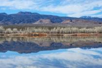
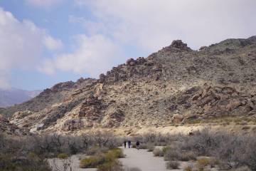
There are at least three strategies for a Bowl of Fire adventure. The Northshore Summit Trail, between mile markers 20 and 21, has a parking lot and a short, steep hike that pays off with panoramas of a section of the Bowl of Fire. Hikers have a perch above the layering of gray, orange, red, tan, brown and pink sandstone and limestone, and that perspective encourages some to seek a longer path through parts of the wilderness area.
While the well-worn Northshore Summit Trail is easy to follow and the trek is typically shared with other hikers, two other approaches have fewer visitors and fainter paths. But red rock beauty and desert solitude await those comfortable with making judgment calls about routes and who have a good sense of the direction in which their car is parked.
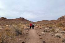
The Bowl of Fire is accessible from a few unmarked parking spots on the left side of Northshore Road just after mile marker 18. There are no signs announcing a Bowl of Fire trail. Instead, hikers will find a faint path a few steps to the west of the parking spots. The path leads through creosote bushes and toward Callville Wash, which needs to be followed and crossed to reach the red rock outcroppings of the Bowl of Fire. The hike can be as long or as short as visitors decide, and gleaning a deeper familiarity with the area before going is advisable.
Another option for those with high-clearance vehicles is to enter the unpaved Callville Wash area near mile marker 16 and drive upstream toward where the red rocks become visible. Hikers, whether driving in or walking, will need to climb the wash’s bank to reach the Bowl of Fire.
A less-ambitious but absolutely worthwhile Northshore Road stop is Redstone Picnic Area, preferably for a late afternoon picnic with golden-light ambiance and sunset skies. This stop at mile marker 27 has an easy and short loop trail offering opportunities to climb around red rock outcroppings and sit inside cubbies of petrified prehistoric sand dunes.
Directions and costs: From the Las Vegas Valley, there are two options. From northern or central locations, follow Lake Mead Boulevard east through North Las Vegas over the pass near Sunrise Mountain and down into Lake Mead National Recreation Area. From southern valley locations, follow Lake Mead Parkway from Henderson, passing Lake Las Vegas and turning left onto Northshore Road. By either approach, you will enter Lake Mead National Recreation Area, where a $25 entrance fee applies, unless you have an annual pass.
For more: nps.gov/lake/index.htm