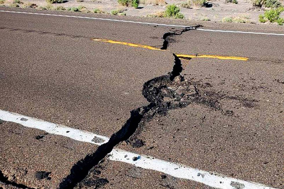
Nevada has 3rd-most earthquakes in the country

It was just before 11 p.m. on Oct. 2, 1915, when brief, recurring temblors felt by residents of two Nevada communities turned out to be precursors of what would prove to be the largest earthquake ever recorded in the Silver State.
The mainshock, or largest earthquake in the day’s sequence of temblors, hit the Pleasant Valley and the small gold mining community of Kennedy (now a ghost town) shortly before 11 p.m., registering a magnitude of 7.3, according to Dr. Kyren R. Bogolub, network seismologist for the Nevada Seismological Laboratory in Reno.
Residents of the two Pershing County communities felt some shaking all day until about 10:55 p.m. “when without the slightest warning a great roar and rumbling was heard and we were thrown violently out of bed and buffeted in all directions continuously for not less than fifteen minutes,” L.D. Roylance wrote in The Silver State (Winnemucca) newspaper.
“Every building (in Kennedy) was razed to the ground with the exception of the mill,” while one ranch in the vicinity “had a crack in the ground fourteen feet wide,” Roylance wrote.
Roylance added that the quake also damaged the courthouse and three hotels in Winnemucca, some 60 miles south of the two communities, and destroyed train depots in Fallon and Carlin.
Active state for quakes
Nevada is the nation’s third-most earthquake active state, behind Alaska and California, the Nevada Bureau of Mines and Geology reports.
More than 220,000 quakes have been recorded in and around the state since the 1850s, including 23 strong ones with magnitudes of 6 to 7.3, according to the bureau.
Why so many quakes?
“The simple reason is there are a lot of active faults in Nevada,” Bogolub said.
“The more complicated reason is tectonic,” she said. “The San Andreas Fault (in California) allows the movement of the Pacific tectonic plate along the North American tectonic plate, but not all the movement is accommodated on the fault. Much of it is accommodated by smaller faults and stretching of the crust of Nevada.
“Nevada has been stretched for a very long time, the basin and range structure we see is the result of that stretching,” Bogolub said. “All those faults between the basins and the ranges have the potential to have earthquakes.”
Unlike California, where the massive San Andreas Fault includes the movements of the Pacific and North American tectonic plates, Nevada is located on a single plate (the North American), nonetheless with faults capable of producing earthquakes in the 7-plus range, Bogolub said.
Nevada’s 7 most powerful earthquakes
The 1915 Pleasant Valley quake tops the list of the seven most powerful shakers in Nevada history, all in the northwestern part of the state, according to the bureau’s report “Living with Earthquakes in Nevada.”
The locations and magnitudes of the state’s next strongest temblors include:
1954: Fairview Peak: 7.2
1932: Cedar Mountain: 7.1
1954: Dixie Valley: 7.1
1954: Stillwater: 6.7
1954: Rainbow Mountain: 6.6
2008: Wells: 6.0
Small temblors in Southern Nevada
Far fewer significant earthquakes occur in Southern Nevada than in the north, but the filling of Lake Mead in the mid-1930s has been blamed for a series of subsequent temblors measured 4 to 5 in magnitude, as large reservoirs such as Lake Mead’s are very heavy and “actually depress the Earth’s crust because of their weight,” according to the Nevada Earthquake Hazard History report on the earthquake awareness website shakeout.org.
The Lake Mead-influenced quakes in Southern Nevada included two temblors in 1939, two in 1942, one in 1947, two more in 1948, one in 1950, four in 1952, one in 1958 and two in 1963, according to the shakeout.org report.
“There were also dozens of smaller earthquakes in Boulder City and at Hoover Dam through these years,” the report states. “Some of the largest events caused minor damage in Boulder City and were distinctly felt in Las Vegas.”
Among the smaller quakes typically recorded in Southern Nevada recorded were one at 2.5 in Las Vegas in 2022 and another at 2.3 about 26 miles southwest of Henderson on April 24.
Based on the Richter scale measurement of quakes, an increase of one point of magnitude denotes a temblor 10 times more powerful, so a strong one measured at 6.3 shook the ground 10 times more than a more moderate 5.3 quake, according to the U.S. Geological Survey.
In 2019, the Nye County Sheriff’s Department officials said a Pahrump man died as a result of a 6.4-magnitude earthquake that occurred July 4, 2019, near Ridgecest, California, about 100 miles away.
On that day, Troy Ray, 55, was working on his Jeep, which was raised on jacks, when the vehicle fell down on top of him because of the temblor, causing his death from traumatic asphyxia.
Contact Jeff Burbank at jburbank@reviewjournal.com or 702-383-0382. Follow him @JeffBurbank2 on X.