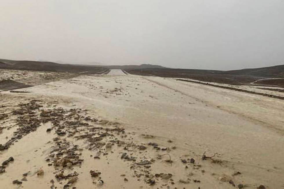
Main Death Valley road closed again because of heavy rain

Heavy rain for the past two days at and near Death Valley National Park forced closure of the main road for several hours before reopening Thursday night.
California Route 190 from 10 miles west of Death Valley Junction to State Route 127 was closed Thursday evening due to flooding. The California Department of Transportation announced the road reopened at 11:30 p.m.
A flash flood warning remained in place until 12:30 a.m. Friday, according to the National Weather Service.
Route 190 in the area of the Death Valley Junction received about 0.75 of an inch to 1.5 inches Thursday evening, according to meteorologist Morgan Stessman.
She said the Furnace Creek area received 0.75 of an inch to 1 inch.
At around 11 p.m., Stessman said there could be an additional half an inch of rain along Route 190 in the next few hours.
Chances for precipitation in the Death Valley area are low on Friday with the highest chance at 10 percent in the higher terrain, according to Stessman.
Several roads were reopened in the park and surrounding areas recently, about two weeks after heavy flooding in the first few days of August.
Damage was estimated to be in the millions.
ATTN DRIVERS: @Caltrans9 has closed State Route 190 from 10 miles west of Death Valley Junction to State Route 127 due to flooding. According to @NWSVegas, a Flash Flood Warning remains in effect until 8:30 tonight. pic.twitter.com/0CFvdHAoqM
— Caltrans District 9 (@Caltrans9) August 26, 2022
Temporary lake
A temporary lake that formed near the Ivanpah Dry Lake because of heavy rainfall on Wednesday is likely growing today.
A lake formed there Wednesday and closed down the southbound side of Interstate 15 from nearly four hours before it was reopened about 7 p.m.
Amazing footage of Ivanpah Dry Lake (Primm Valley) which is currently filled with water thanks to heavy storms yesterday. #cawx #nvwx https://t.co/WkotSJvi6P
— NWS Las Vegas (@NWSVegas) August 25, 2022
A flash flood warning that runs until 5:15 p.m. was issued for the same stateline area that received heavy rain on Wednesday.
⚠️ Flash Flood Warning ⚠️
Until 5:15pmHeavy rain in areas that received copious amounts of rain yesterday will result in flash flooding, particularly along roadways that intercept Wheeler Wash including State Route 160 east of Pahrump.
Turn around, don't drown!#NvWx pic.twitter.com/Kg9RyuCPFk
— NWS Las Vegas (@NWSVegas) August 25, 2022
More than a month of monsoon weather may be coming to an end, according to the latest National Weather Service forecast.
Nearly 12 inches of rain has been recorded at Mount Charleston in Southern Nevada’s wettest monsoon season in 10 years. The rain gauge closest to the peak recorded 1.38 inches on Wednesday alone.
Friday should be mostly clear with a high near 100 and a Saturday morning low near 79. Sunday is forecast to be nearly identical, as is Monday.
After Thursday, no precipitation is listed in the current forecast that runs until Wednesday.
Lake Mead up 2.72 feet
The monsoon has helped Lake Mead rise 2.72 feet in the past month.
The surface of the lake was at 1,043.43 feet above sea level as of 7 p.m. Wednesday, a rise of 2.72 feet or 32.64 inches.
The rise of an inch equals about 68,000 acre-feet, according to the Bureau of Reclamation. One acre-foot is about 326,000 gallons of water.
Contact Marvin Clemons at mclemons@reviewjournal.com. Follow @Marv_in_Vegas on Twitter. Review-Journal reporter David Wilson contributed to this report.