Clark County maps provide ZIP code, city data for COVID-19

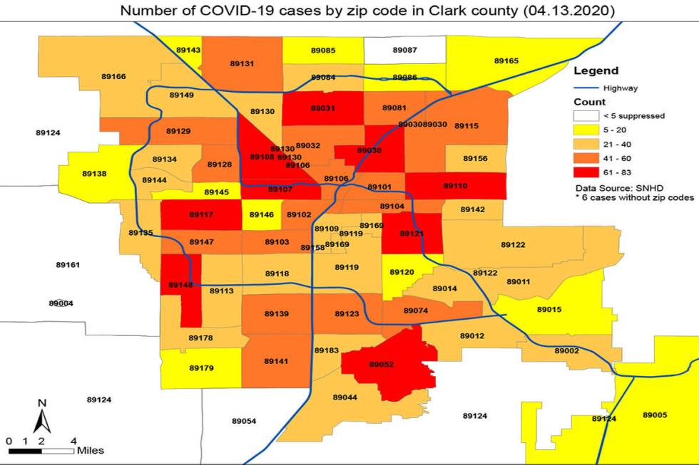
For the first time Tuesday, the Southern Nevada Health District posted detailed data on the number of COVID-19 cases in Clark County by ZIP code and city, offering a first look at local hot spots for the disease.
The city map shows Las Vegas reporting 1,694 cases of the new coronavirus, well over half of the 2,509 confirmed cases countywide. North Las Vegas was next, with 259 confirmed cases, followed by Henderson (250), Boulder City (18) and Mesquite (6). The map indicated that the district had no location information on 257 cases.
The ZIP code map showed central Las Vegas and pockets spread around the valley with the highest concentration of cases.
The ZIP codes reporting the most confirmed cases — between 61 and 83 — included 89030, 89031, 89052, 89110, 89107, 89108, 89117, 89121 and 89148.
Health district spokeswoman Jennifer Sizemore said that the ZIP codes correspond with the infected person’s home address for the most part. In some cases, they represent where a person was tested for the coronavirus.
By and large, the highest number of cases were in the most populous ZIP codes.
Contact Mike Brunker at mbrunker@reviewjournal.com or 702-383-4656. Follow @mike_brunker on Twitter. Review-Journal staff writer Michael Scott Davidson contributed to this report.
COVID -19 cases by Zip Code in Clark County by Las Vegas Review-Journal on Scribd
COVID-19 Cases by City in Clark County by Las Vegas Review-Journal on Scribd