NASA satellite imagery shows 40 years of growth in Las Vegas Valley
In case you hadn't heard, Las Vegas grew a bit over the past 40 years.
Now NASA has found a way to illustrate that eruption in less than a minute.
Using detailed satellite images from the agency's Landsat program, the Goddard Space Flight Center in Maryland has created a video charting the valley's sprawl from 1972 through 2010.
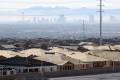
In the span of 40 seconds, Las Vegas expands outward like a stucco tsunami, pushing west toward Red Rock Canyon. It actually resembles a rash, thanks to the false-color images that show vegetation in red and roads and buildings in gray.
Goddard spokeswoman Aries Keck said they picked Las Vegas because they were looking for a dramatic example of growth over a relatively short span of time.
"This is one of the places where you see an incredible amount of change. Las Vegas just exploded," Keck said.
The first frame of the video shows the valley in 1972, when it was home to about 300,000 people. In the last frame, 2010, the population stands at almost 2 million.
The animation was created to mark the 40th anniversary of the Landsat program and the 28th birthday of Landsat 5, one of the satellites that took the images. Keck said Landsat 5 is longest-running satellite in a program that has produced the longest continuous record ever made of the Earth's surface.
Goddard posted the Vegas sprawl video -- complete with a jazzy drum beat -- on YouTube last week and added it to the space center's Flickr web page on Monday. Keck said the video is due to be featured on NASA's main website, NASA.gov, later this week.
The staff at Goddard also stitched together satellite images of Southern Nevada to show the rise and fall of Lake Mead in recent decades. The alarming animation ends with a record decline in the lake over the past 10 years, which plays out in the same frame as Henderson's rapid expansion. It's mostly a coincidence because the valley's water use has very little impact on the size of Lake Mead. Nearly all of the water drawn from the reservoir goes downstream to farms and cities in California, Arizona and Mexico.
Landsat is a joint effort by NASA and the U.S. Geological Survey. The program is due to launch its newest satellite, Landsat 8, in January
That should mean more images of a Las Vegas that already has proven to be quite entertaining, even from orbit.
"You can see the Strip. You can see the airport get bigger," an excited Keck said of the video. "It's like the video game Sim City."
Review-Journal writer Lynnette Curtis contributed to this report. Contact reporter Henry Brean at hbrean@reviewjournal.com or 702-383-0350.
more images