Arizona officials study 3 possible routes for future I-11
Almost a year after the first 15 miles of new road for Interstate 11 opened to vehicle traffic, where the road goes from there is still up in the air.
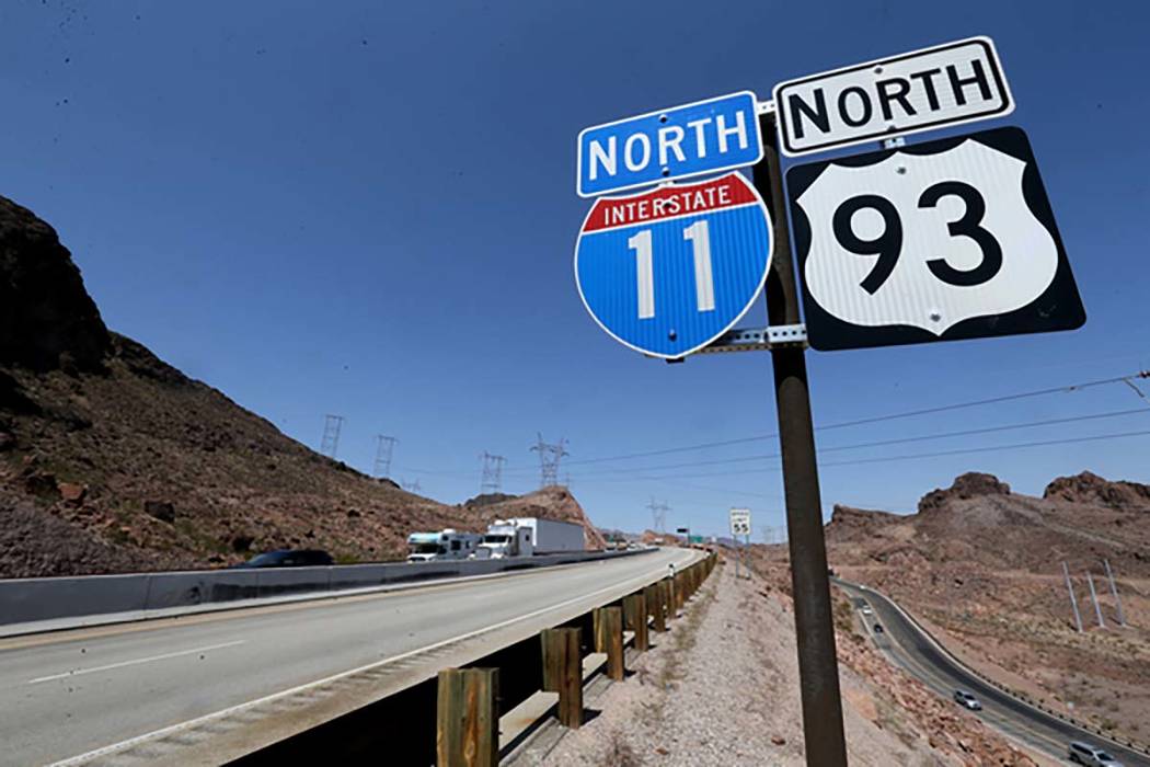
The initial portion of I-11 now runs from the Henderson Spaghetti Bowl to the O’Callaghan-Tillman Memorial Bridge near Hoover Dam and was a joint effort between the Nevada Department of Transportation and the Regional Transportation Commission of Southern Nevada.
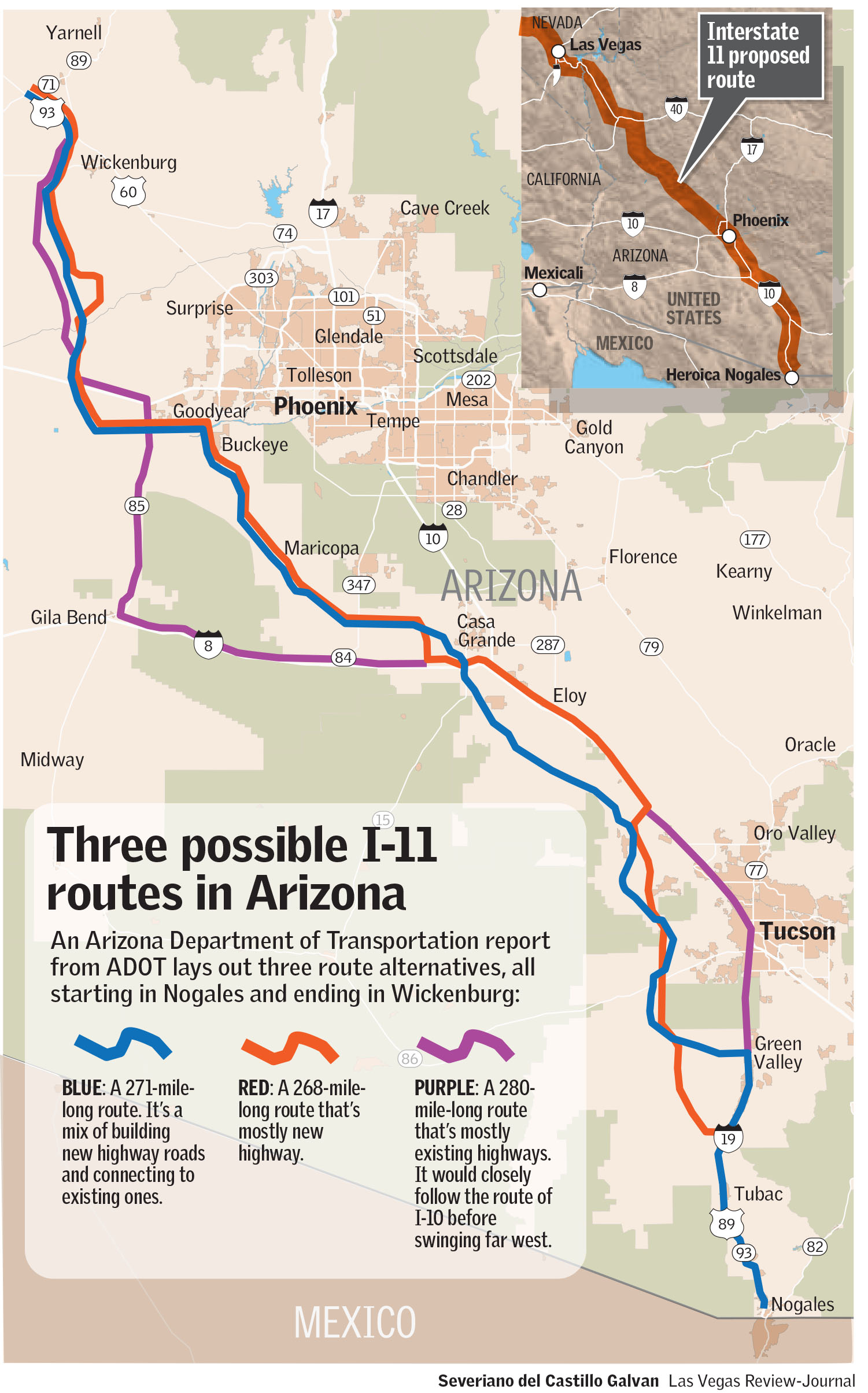
Arizona officials are studying three possible routes for a 280-mile highway that would run from Nogales, Arizona, near the Mexico border up to Wickenburg, Arizona, about 65 miles northwest of Phoenix. From there it would link up with U.S. Highway 93, which is a designated future I-11 route, to Las Vegas.
I-11, the first new Interstate in the U.S. since 1992, is touted as a vital link between Las Vegas and Phoenix, the two largest U.S. cities not connected by an interstate. The ultimate goal is much larger than that, though, as the interstate could potentially open a north-south trade route linking Mexico and Canada.
Plans for Arizona’s portion of I-11 are still tentative, and the possible price tag has yet to be determined. The Arizona Department of Transportation estimated the cost at between $3.1 billion and $7.6 billion.
A Tier 1 environmental draft released by ADOT in April gave residents an idea of where the I-11 corridor would be located. Public hearings and an open comment period followed its release.
“The hearings were designed to give people the opportunity to learn more about the study, where we are in the process and also provide their formal comments about what they think about I-11 and what we’re proposing in our environmental draft impact statements,” said ADOT spokeswoman Laura Douglas.
The department is conducting further environmental impact studies slated to wrap up next year for the corridor.
Possible routes
The study identified three possible routes for the interstate, Douglas said. Two would use mostly new highway, and one would use both new and existing highway through the corridor.
“Right now in the draft environmental impact study we’re studying both the build and no-build alternative,” she said. “That will be something that’s selected at the end of this particular study.”
If any existing highways were incorporated into I-11, those roads would need to be rebuilt to meet interstate standards.
“We would need to create access control with on- and off-ramps, traffic interchanges and things like that,” Douglas said.

That is how U.S. 93 is also being viewed, although it’s not part of the current ADOT I-11 study. Since it’s the designated route for the future I-11 between Wickenburg and Nevada, that stretch of road would be built out to interstate standards as well.
Portions of the proposed I-11 corridor would run through areas where homes and businesses are currently located, prompting some concern from area residents.
“To us, it’s just disrupting hundreds of lives for no reason,” Jody Arnold, who lives with her husband on the fringe of metro Phoenix, told the Arizona Republic. “It’s just like a bulldozer coming through and taking everything out.”
But Douglas said it’s unclear how many residents would be in the path of the proposed highway, noting that the 2,000-foot-wide corridor identified by ADOT will be reduced to 400 feet when the impact study is completed next year.
“While people might be concerned that perhaps their property or homes fall within that 2,000-foot corridor, that’s not what is ultimately selected should a build corridor move forward,” she said. “The Tier 2 studies will narrow the corridor to a 400-foot-wide alignment, and that’s where you get into specifics of where I-11 would run, whose property would be impacted and some of the more specific questions are dealt with in Tier 2 studies.”
Once the I-11 route is decided, the interstate is still a long way from becoming a reality.
There is no timetable for when construction could begin, and funding has yet to be lined up, Douglas said. The price tag would depend on the route chosen and the amount of existing highway used.
For reference, the 15-mile stretch of I-11 in Nevada cost $318 million to construct. That involved controlled blasting through the Eldorado Mountains to make way for the road’s path toward the Colorado River. That portion was funded with a mix of federal and state dollars through Clark County’s fuel revenue indexing tax.
Arizona doesn’t have a fuel tax going toward road projects, so funding for the road construction could be more difficult.
Northern expansion
With Southern Nevada getting the I-11 project in motion, NDOT is in the early stages of planning where the interstate could go from its current end in Henderson to the northern part of the state.
NDOT spokesman Tony Illia said the agency is in negotiations with a firm to carry out a Tier 1 environmental document for the Clark County/Urbanized Southern Nevada portion, which will lead to identifying a corridor, though not necessarily a specific route.
Last year, NDOT completed the I-11 Northern Nevada Alternatives study for the areas north of urbanized Clark County.
“We are looking at incremental improvements along the U.S. 95 corridor south of Tonopah,” Illia said.
Possible future routes from Clark County to the north that will be evaluated in the Tier 1 study include:
— West on the 215 Beltway, linking to U.S. Highway 95.
— North on U.S. 95 through the Spaghetti Bowl to the northwest end of the valley.
— A new eastern corridor that could include building a freeway running from Lake Mead National Recreation Area past Frenchman Mountain — about 8 miles east of Las Vegas — before emerging at I-15 to connect with the 215 Beltway and west to U.S. 95.
— I-11 through northwest Las Vegas by way of U.S. 95 to Tonopah, a designated Future I-11 route. NDOT is considering incremental improvements on the stretch, including passing lanes and shoulder widening.
— Running up through Silver Springs and Fernley.
— A path through Fallon.
Contact Mick Akers at makers@reviewjournal.com or 702-387-2920. Follow @mickakers on Twitter.
Related
I-11 near Boulder City features bridge, underpasses for sheep
5 things to know about I-11 near Boulder City
I-11 offers visual treat for Southern Nevada motorists


