Governor expands weather emergency to 11 counties


Nevada Gov. Joe Lombardo expanded a state of emergency Saturday night because of ongoing severe weather conditions in Northern Nevada.
Now, 11 of Nevada’s 17 counties are covered by the declaration as well as Carson City and a tribal community.
Areas impacted by the weather include: Carson City as well as Churchill, Douglas, Esmeralda, Elko, Eureka, Humboldt, Lyon, Mineral, Nye, Storey, Washoe and White Pine counties and the Yomba Shoshone Tribe.
“As severe weather conditions continue throughout the weekend, the emergency declaration may be further updated to include additional affected counties and tribal nations,” a news release stated.
Interesting views from Ella Mountain in southeastern Lincoln County as a storm passed to the north!
Images courtesy of @NVSeismoLab. #nvwx pic.twitter.com/sMrWIeD8ah
— NWS Las Vegas (@NWSVegas) March 12, 2023
The severe weather included heavy rainfall, flooding, rockslides, avalanches and infrastructure damage.
“As this severe weather continues to impact more residents across northern Nevada, I again urge all Nevadans to stay safe, travel cautiously, and to follow all local guidance,” the governor was quoted in the news release. “State and federal partners will continue to monitor local damage and will work quickly to assess needed repairs across northern Nevada.”
Lombardo’s original declaration on Friday included Churchill, Douglas and Lyon counties as well as the Yomba Shoshone Tribe.
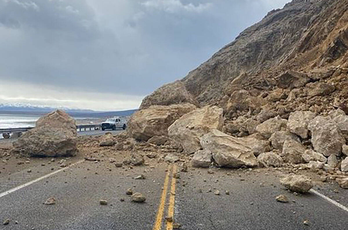
U.S. 95 closed
Earlier Friday, the Nevada Department of Transportation advised drivers to expect U.S. 95 to remain closed temporarily in the Walker Lake area following major rockfall across the highway.
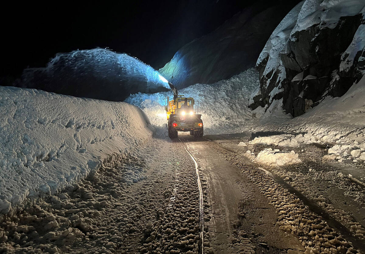
Within hours of the Friday morning event, the Nevada Department of Transportation teamed up with a local construction contractor to begin rock removal.
The road was reopened on Saturday, according to NDOT.
Both directions of U.S. 95 are NOW OPEN between Hawthorne and Schurz.
Thanks to the crews who worked through the day and night to clear the boulders which fell across the highway yesterday after heavy rains.
Highway updates: https://t.co/j1HkXFNX8R pic.twitter.com/PZi53SZ6Nd
— Nevada DOT Reno (@nevadadotreno) March 12, 2023
US 95 was closed between Schurz and Hawthorne near Walker Lake. Large boulders were covering the pavement. Hawthorne is 314 miles northwest of Las Vegas
The section of highway is traveled by more than 4,000 drivers a day.
The areas of Ione, Yomba Reservation and Railroad Valley were experiencing flooding as of Friday afternoon, according to Nye County.
“Information is that there are no passable roads in or out of the areas. Northern Nye County Search and Rescue is on stand-by,” an emailed news release stated. “Emergency Management is working on getting tractors for rescue/evacuation if necessary. Shelter in place and call the Nye County Sheriff’s Office or EMS for emergencies.”
Heavy rain began Thursday in the Bay Area and atmospheric rivers of rain and snow are expected to hit central California and the Sierra Mountains into next week. Some mountain passes are expected to get 100 inches of snow or more this weekend.
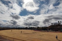
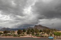
Wind, rain in Las Vegas
Clark County enjoyed mostly sunshine on Saturday after some rain in the Mount Charleston and northwest valley on Friday.
In Las Vegas, rain fell in the afternoon with the Red Rock Canyon area receiving nearly a half-inch. Mount Charleston logged 1.38 inches, Harris Springs recorded .75 of an inch and Calico Basin had received .43 of an inch.
The Red Rock Visitors Center had a wind gust of 52 mph at 9:30 a.m. Friday while Harry Reid International Airport logged a gust of 40 mph at 4:20 p.m.
Skies cleared Saturday for a high near 74.
Sunday should be sunny with a high near 74. Southwest winds of 5 to 7 mph will become east-southeast in the morning.
This is the first time I can ever recall seeing the National Weather Service forecast FOUR major mountain passes in California to see over 100 inches of snow from one storm.
Just humongous snow totals. pic.twitter.com/JtQfM8Rvoa
— Colin McCarthy (@US_Stormwatch) March 9, 2023
Sierra snow may be massive
Snowfall in the Sierra Mountains along the California-Nevada line could be massive.
The weather service is predicting 100 inches of snow or more in four mountain passes — Carson, Ebbetts, Sonora and Tioga passes — as well as 60 to 80 inches in Donner Pass.
The Sierra Nevada is about to see up to another 10-15 feet of snow above 8,000 feet in just the next 7 days. Up to 10 feet of snow could fall just through Sunday above 9,000 feet!
Keep in mind California's snowpack is already one of the biggest in modern history. pic.twitter.com/LwvJB6EQAp
— Colin McCarthy (@US_Stormwatch) March 9, 2023
The area has been hit by massive snow already and this storm includes an atmospheric river with heavy rainfall anticipated.
With back-to-back storms to hit California, state officials are scrambling to make strategic releases from key reservoirs in hopes of preventing a repeat of the deadly flooding that killed nearly two dozen people in January.
Periods of valley/coastal rain & heavy mountain snow will continue for portions of northern & central California this weekend. By late Monday into Tuesday the next storm system arrives, delivering another round of excessive rainfall & heavy mountain snow to the West Coast. #CAwx pic.twitter.com/B22Dnc1Ppy
— NWS Weather Prediction Center (@NWSWPC) March 10, 2023
At least 10 rivers are forecast to overflow from the incoming “Pineapple Express” storm, which is expected to drop warm, heavy, snow-melting rain as it moves from the Central Coast toward the southern Sierra beginning Thursday night into Saturday.
Among them are rivers that flooded at the start of the year, when nine atmospheric river storms pummeled the state. The waterways include the Cosumnes River near Sacramento, where more than a dozen levee breaches sent floodwaters onto roadways and low-lying areas, trapping drivers and contributing to at least three deaths along Highway 99.
“This is a very dynamic system,” Department of Water Resources Director Karla Nemeth said at a briefing Thursday. “Rivers and creeks can rise very quickly, and so it does have the potential to be a dangerous situation, particularly in areas that had experienced flooding before.”
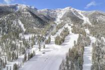
Lee Canyon at 217 inches
No snow has fallen at Lee Canyon in the past 48 hours, but some was expected Thursday overnight and again on Tuesday. The resort in the Spring Mountains has recorded 217 inches at Rabbit Peak this season and has a 95-inch base.
Contact Marvin Clemons at mclemons@reviewjournal.com. Follow @Marv_in_Vegas on Twitter. The Associated Press contributed to this report.