Relief from intense Las Vegas heat a few days away
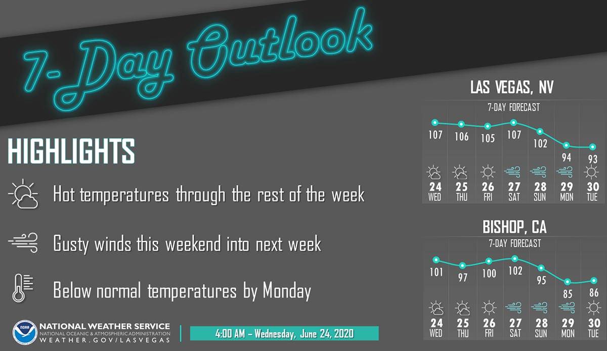
Relief from the Las Vegas heat spell is on its way, but you’ll have to wait several days for it.
“It is a potent weather system from the Pacific Northwest,” National Weather Service meteorologist Chelsea Kryston said. “The winds will start on Saturday and then we will have widespread gusts up to 40 mph on Sunday, possibly higher.”
The actual cold front is expected to move through Las Vegas on Monday, and high temperatures will drop into the low 90s starting Monday.
ICYMI, here are some helpful tips to remember to hydrate!
1. Use colorful water bottles. 💚
2. Set alarms. ⏰
3. Place reusable water bottles in areas you frequent. 🚙
4. Spruce it up with lime, lemon or mint. 🍋
5. Drink tea or try sparkling water! ☕ #NationalHydrationDay https://t.co/SccUWJo9wp— NWS Las Vegas (@NWSVegas) June 23, 2020
“It will be nice,” Kryston said.
Until then, the heat will continue.
After a high of 108 at McCarran International Airport on Tuesday, the high on Wednesday will be around 107 with winds of 5 to 11 mph.
Thursday will probably top out about 107, and Friday’s projected high is 106, the weather service says.
“There is a weak weather system moving through Thursday and Friday, but it will only drop the highs a degree or two,” Kryston said.
Contact Marvin Clemons at mclemons@reviewjournal.com or 702-863-4285. Follow @Marv_in_Vegas on Twitter.


