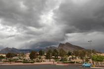
Storm hits hard northwest of Las Vegas; Sunday breezes forecast


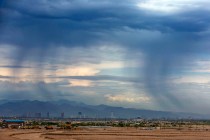
A storm that moved primarily west to east dropped most of its moisture northwest of Las Vegas overnight, limiting its impact in the valley.
“The west-east orientation allowed the bulk of the moisture to hit the Sierras and Owens Valley more than we had thought,” National Weather Service meteorologist Brian Planz said.
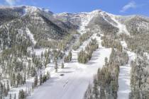
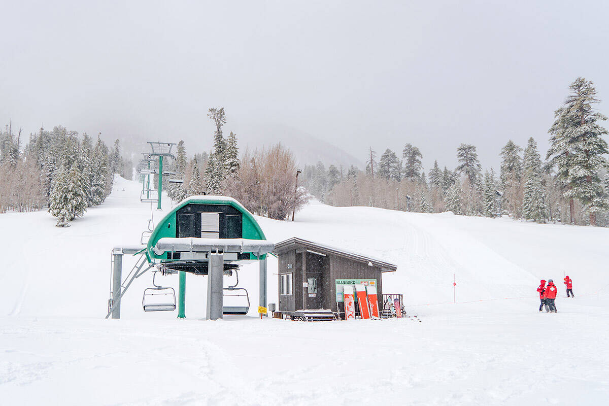
The Mount Charleston Fire Station reported 2.5 inches of snow overnight while Lee Canyon officials did not respond to questions about overnight snowfall.
An earlier forecast called for up to 6 inches of snow at Lee Canyon after the resort recorded 15 inches overnight Thursday.
Harry Reid International Airport recorded a trace of rain overnight while North Las Vegas Airport was showing light rain as of 8:10 a.m. Winds at Harry Reid gusted to 40 mph shortly before 6 a.m. before dropping to about 10-15 mph.
Gusts at Henderson Executive Airport remained around 30 mph as of 9 a.m.
A wind advisory remains in position until noon Sunday for the Las Vegas Valley while it has been cancelled for southern Nye County and western Lincoln County.
“It’s clearing up and the winds are dying down,” Planz said. “Other than being a bit breezy it should be a nice Sunday.”
A Sunday high near 55 is expected with winds up to 25 mph. The overnight low will be about 37.
More moisture is forecast for Monday afternoon and evening, but recent weather models show possible precipitation totals declining, Planz said, adding that it could also be more of a west-to-east path.
Contact Marvin Clemons at mclemons@reviewjournal.com. Follow @Marv_in_Vegas on Twitter.