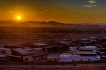
Super Bowl week: Soggy, chilly in Las Vegas until weekend


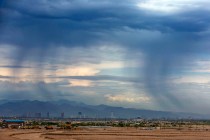
Keep your rain gear handy along with a warmer jacket. It will be a wet and chilly Super Bowl 58 week in Las Vegas.
After Sunday, the sun might not be seen until late in the week. On the bright side, next weekend’s forecast is for clear skies, including the Chiefs-49ers clash.
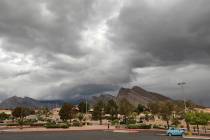
Despite less-than-ideal conditions, Las Vegas Valley residents and several hundred thousand visitors might be fortunate when compared to nearby California and counties north of Clark County.
A second “Pineapple Express” this week started arriving on the Pacific coast Saturday evening. It is expected to cause heavy rain and flooding with possible life-threatening conditions. Some evacuation orders were already issued earlier Saturday.
The main part of the system was still a few thousand miles out in the ocean, pulling precipitation from the equator toward the Southwest United States.
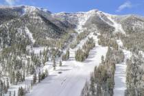
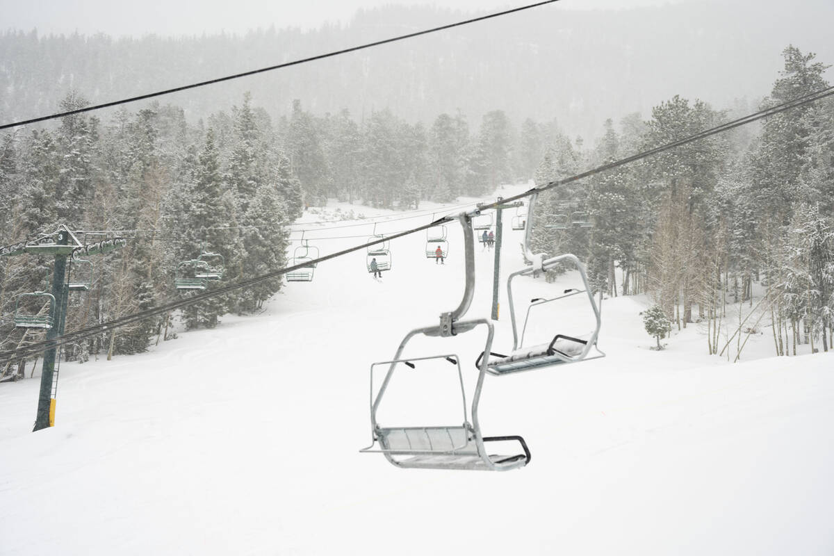
Another winter storm will impact the Spring Mountains starting tomorrow evening - with periods of heavy snow continuing into Tuesday night. Snow may be measured in feet across parts of Lee and Kyle Canyon by the time the storm winds down. #nvwx pic.twitter.com/nxziXUXpTE
— NWS Las Vegas (@NWSVegas) February 3, 2024
Mixed Sunday in Las Vegas
Some precipitation was approaching the Spring Mountains and Pahrump late Saturday night, meteorologist Morgan Stessman said.
“It looks like a band setup and if it shifts east, the rain might fall early Sunday in the valley,” Stessman said. “The Spring Mountains may get 1 to 3 feet during the storm.”
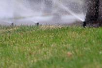
Showers are a 40 percent chance Sunday morning.
The sky should become sunny in the afternoon with a high near 58, according to the National Weather Service.
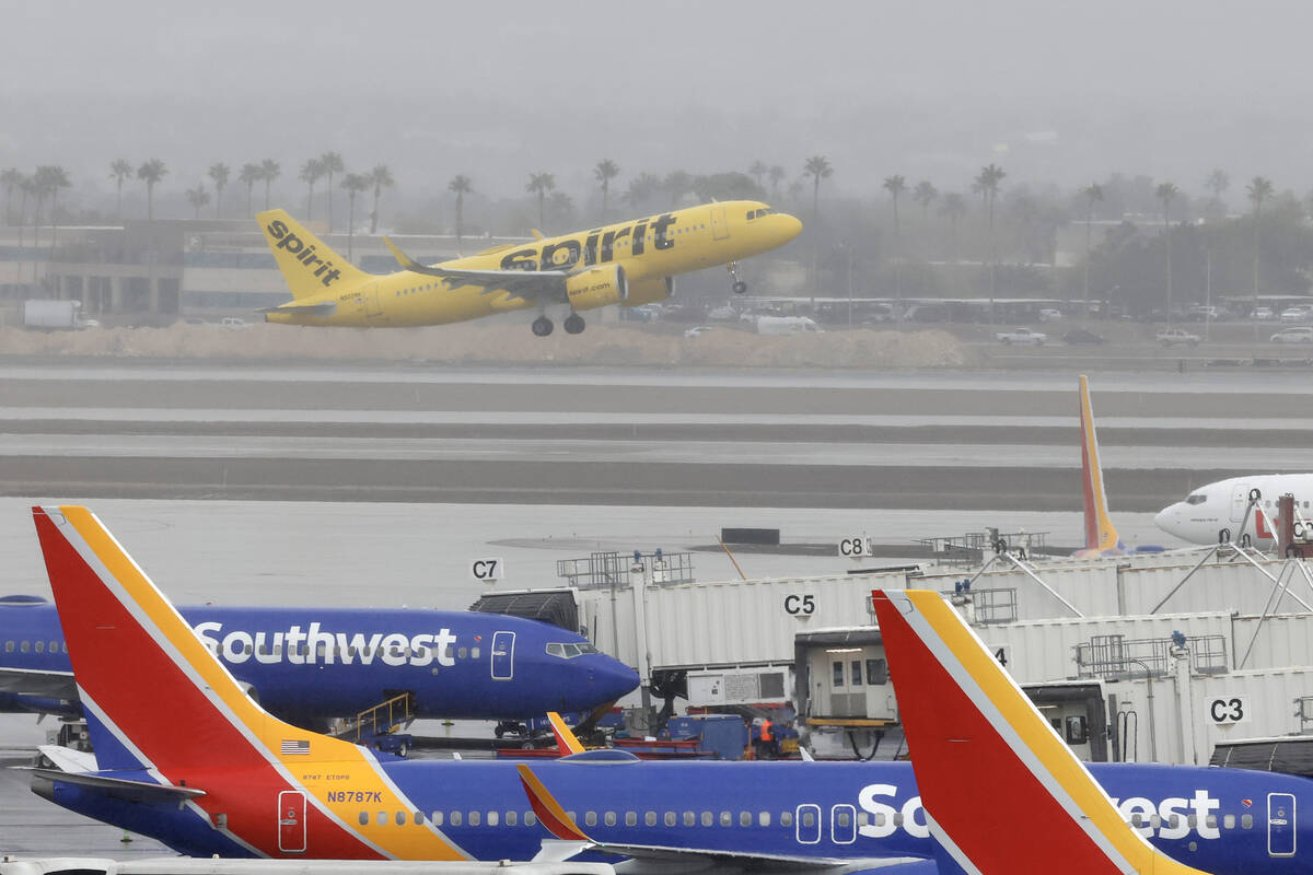
Inbound flights to Harry Reid International Airport were being held at their origin Sunday morning until 9:30 a.m. due to low clouds, FlightAware reported.
At 2 p.m., inbound flights were delayed at their origin by about 1 hour and 6 minutes, on average. Departing flights were being delayed between 31 and 45 minutes, FlightAware said.
Showers chances rise to 50 percent Sunday night.
The west and central areas of the valley saw between 0.04 and 0.08 inches of rain early Sunday morning, according to the Clark County Regional Flood Control District. A few gauges around Red Rock Canyon recorded around 0.12 inches.
The Monday morning low will be around 46 while showers will be a 70 percent chance with a high near 56.
Tuesday could be the wettest day of the week with precipitation chances rated at 90 percent during the day and 80 percent in the evening.
Daily highs through Thursday will be in the mid-50s with morning lows close to 40.
Thursday and Friday have lower probabilities of rainfall with Saturday and Sunday expected to be mostly sunny and a bit warmer.
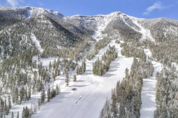
Winter storm warning
The storm will impact the Spring Mountains starting Sunday evening, with periods of heavy snow continuing into Tuesday night. Snow may be measured in feet across parts of Lee and Kyle Canyon by the time the storm winds down.
Lee Canyon has received 20 inches in the past week with most of that falling Thursday and Friday. The weather service said early Sunday morning that heavy snow is expected at elevations above 6,000 feet, and about 2-4 feet of snow is expected at elevations between 7,000 and 9,000 feet. Winds may gust to 55 mph, and bring down tree branches.
Snowy conditions could make travel through Kyle and Lee canyons impossible at times, the weather service said.
Go Mt. Charleston said in an X post Sunday that thr Spring Mountains Visitor Gateway will have a delayed opening Sunday morning. Snow chains or tires are required for Kyle Canyon, Lee Canyon, and Deer Creek roads.
The Eastern Sierra Slopes, White Mountains in Inyo County, high elevations in Death Valley National Park as well as Esmeralda and Central Nye counties are under a winter storm warning from 4 a.m.Sunday to 4 a.m. Tuesday.
An atmospheric river is bringing heavy precipitation from the California coast into the Great Basin.
It wouldn't be unsettled weather without some hazards. Right now we have some Winter Storm Warnings, a Winter Weather Watch, a High Wind Watch, and a Flood Watch out for various portions of our forecast area. ❄️🏔️🌧️🌬️#CAwx #NVwx https://t.co/zMMqRB8PbH pic.twitter.com/oUS12XcsaA
— NWS Las Vegas (@NWSVegas) February 3, 2024
Flooding is also possible in Death Valley National Park and the Owens Valley with some areas expected to get 1-2 inches or more of rain.
From Sunday afternoon through Monday afternoon, excessive runoff may result in flooding of creeks, streams, washes and other low-lying and flood-prone locations. Low-water crossings may be flooded.
Contact Marvin Clemons at mclemons@reviewjournal.com. Follow @VegasMarvRJ on X.