Wind gusts hit 64 mph at Lee Canyon, 49 mph at Allegiant Stadium

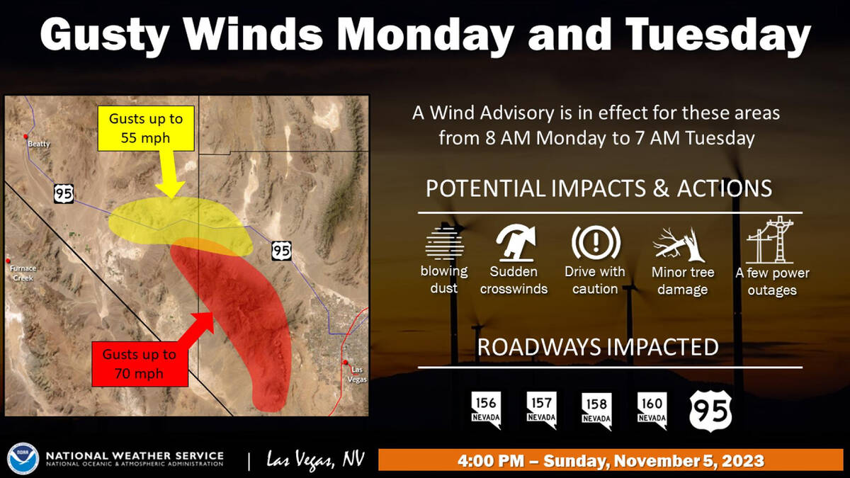


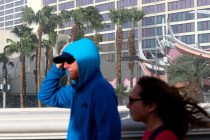
Wind gusts reached 64 mph at Lee Canyon and 49 mph at Allegiant Stadium on Monday as the first phase of a significant cooldown arrives in the Las Vegas region.
With a cold front moving into the region, high temperatures by Wednesday will be in the mid-60s with morning lows in the mid-40s, says the National Weather Service.
Peak gusts at the three public airports were brisk as well. Harry Reid International Airport reached 41 mph just before 1 p.m., while Henderson Executive Airport and North Las Vegas Airport reached 38 mph during the late morning hours.
Angel Peak recorded a gust of 58 mph Monday, while a gauge at Kyle Canyon reached 50 mph. Steady winds of 25-30 mph were being felt across the entire Las Vegas Valley.
The gusting winds were lifting dust from the dry lake beds near Jean and moving it toward the valley early in the day.
Blowing dust, sudden crosswinds, minor tree damage and a few power outages are possible as a result of the strong winds.
“The wind gusts will continue until about dark, and they should be a bit less on Tuesday,” weather service meteorologist Chris Outler said from the Las Vegas office. “The valley (high temperatures) will be down to the 70s on Tuesday and probably into the 60s on Wednesday.”
A wind advisory for the Spring Mountains runs until 7 a.m. Tuesday. Gusts to 70 mph are possible, Outler said.
“Just downwind from Lee and Kyle canyons will likely see the strongest gusts, but strong gusts could happen anywhere,” Outler said.
The Monday high at Reid airport reached 78 at several points, but temperatures will head steadily downhill over the next few days.
The forecast for the airport lists wind gusts to 30 mph possible Tuesday and Wednesday.
Contact Marvin Clemons at mclemons@reviewjournal.com.