
Big growth (and traffic) are coming to the I-15 corridor south of Las Vegas


Officials are planning for potential growth around Interstate 15 between Sloan and the California state line and what travel effects that might have on the important stretch of highway.
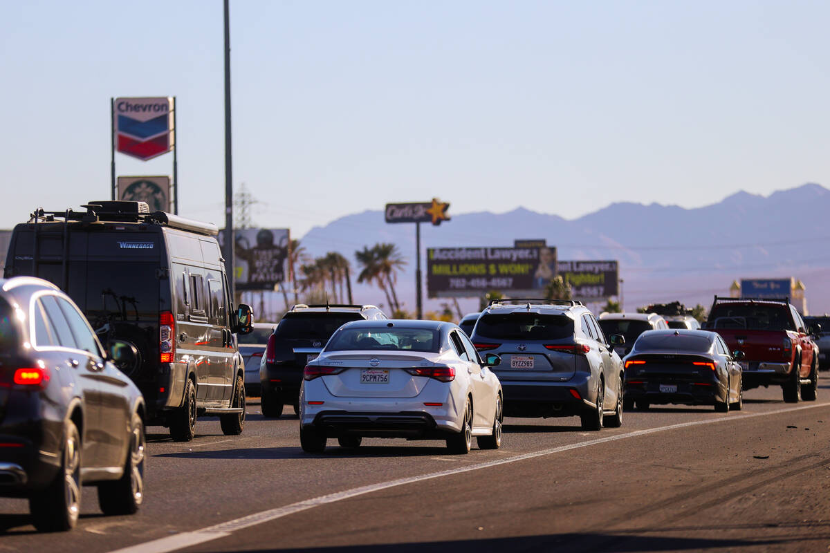
The area that has long been desolate, outside of Primm, could see a flurry of activity that could see the traffic capacity of I-15 surpassed.
From the Brightline West high-speed rail project running through the area with a planned maintenance facility in Sloan, to a long-planned supplemental airport near Primm and the potential to see the Las Vegas Valley further extend toward Sloan with a mix of residential, commercial and industrial real estate, transportation officials are bracing for an increase of motorists on the highway over the next decade-plus.
“The I-15 in this section goes through predominantly undeveloped land; however, in recent years the area has gained immensely in development, redevelopment and new modes of transportation,” Danja Petro, assistant chief of project management for the Nevada Department of Transportation in Southern Nevada, said during the March 10 NDOT board meeting.
The majority of the potential development is planned to occur to the east of I-15, with a small portion of the mixed-use development and the Brightline maintenance facility planned to be constructed west of the highway.
“All of this development as well as increased tourism in the valley are expected to change the travel patterns in this corridor,” Petro said.
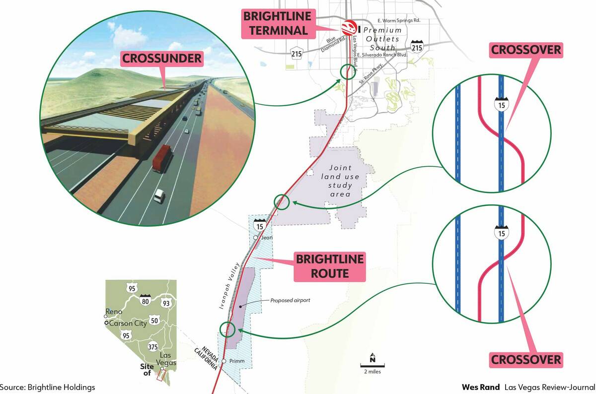
Brightline West
Construction on the proposed Brightline West high-speed rail line is expected to get underway later this year. The 218-mile project between Las Vegas and Rancho Cucamonga will feature 34 miles of rail line on the Nevada side.
The rail line will partially operate in the median and partially on the east side of I-15, a detail that had not been disclosed until the NDOT meeting.
The rail line would intersect with I-15 at three points along the stretch of I-15 between the state line and just north of Saint Rose Parkway.
Two of the crossings will be crossovers, where I-15 will travel above the rail line. One of those is planned to move the rail line from the median to the east side of the highway just north of state line and the other would be north of Jean where the line would move back into the median.
The final I-15 intersection would occur just north of Saint Rose Parkway, where the rail line would travel above I-15 back onto the east side of the freeway, where it will remain until reaching the planned Las Vegas Station on Las Vegas Boulevard between Blue Diamond and Warm Springs roads. The rail line will cross over and under the multiple I-15 interchanges between Starr Avenue and the Las Vegas station, so there will be no at-grade crossings.
To accommodate Brightline’s movement, I-15 northbound will be realigned to allow for the tracks to move back and forth.
There would also be two emergency crossovers to be used by law enforcement and first responders. They would be located 3 miles south and 7.5 miles south of the I-15/Sloan interchange.
Joint land use
Henderson and Clark County are looking to expand the Las Vegas Valley’s urban footprint farther south past Henderson.
Nearly 31,000 acres of land is being evaluated between Sloan and Jean as part of a joint land use study being carried out by the two jurisdictions. The expansion hinges on the passage of the Southern Nevada Economic Development and Conservation Act, also known as the Clark County Land Bill.
Sen. Catherine Cortez Masto reintroduced the act last week, noting the need for additional land as Southern Nevada continues to grow.
“For years, I have worked with community leaders across Clark County to create this legislation,” Cortez Masto said in a statement. “As more and more people call Las Vegas home, we need to find a solution that promotes responsible economic development, builds more homes families can afford, and protects our environment and outdoor recreation. This much-needed bill is that commonsense solution, and I’m going to continue working get it done.”
Potential land uses associated with the initiative include industrial, residential, mixed-use and retail and hospitality.
If the full buildout of land is able to be reached, NDOT anticipates more than 140,000 vehicles added per day on the I-15 corridor between Jean and Las Vegas.
“Which will significantly impact capacity of I-15, if the disposal boundary is extended,” Petro said. “This growth is expected to exceed the potential reasonable capacity of I-15, which will trigger the need for additional local roadway network alternatives.”
Supplemental airport
Early environmental studies are already underway to get construction on the long-planned Southern Nevada Supplemental Airport underway in the coming years.
The Clark County Department of Aviation hopes to have the airport, which would support Harry Reid International Airport as it nears capacity, by 2037.
The project would see 17,000 acres dedicated to facility compatible uses, with the airport itself planned to be constructed on a rectangular portion of land just east of I-15, between south of Jean and just north of Primm.
Once opened, the airport is expected to add an additional 5,600 vehicles daily to the I-15 south corridor. The airport’s construction would likely lead to three additional interchanges being added to I-15, two between Jean and Sloan and one between Jean and Primm.
Once the environmental study on the airport is completed, the types of uses that will occur there, from long-haul, passenger and freight operations, will be revealed. A better idea of how vehicle traffic on I-15 will be affected will be determined at the time.
Looking toward the future and to plan for the potential exponential growth of I-15 between Sloan and the state line, NDOT has initiated an engineering feasibility study for the section of freeway.
“That would help us make strategic decisions with the goal of improving the access and operation and providing safe and reliable travel along this section of I-15,” Petro said. “This study will serve as a blueprint on how to accommodate current and future needs and will allow us to identify any potential trigger points and timeline for I-15 improvements in the future.”
NDOT Director Tracy Larkin Thomason said this study is particularly important because of the critical nature the stretch of I-15 plays for the valley and its movement of goods and visitors.
“I-15 is our lifeline coming into Las Vegas from California, so the work here is really working very closely with all the stakeholders ahead of time to make sure that we access I-15 appropriately and project it as much as possible,” Larkin Thomason said. “We don’t have alternatives; we don’t have an alternative freeway going to California.”
Contact Mick Akers at makers@reviewjournal.com or 702-387-2920. Follow @mickakers on X.


