Find beauty, history and serenity in tranquil waters of Black Canyon
On a windless day, the border that divides southwest Nevada from Arizona sparkles like glass.
The narrow ribbon of blue water that stretches from Hoover Dam to Willow Beach meanders between the towering cliff sides of the two states and laps against small, sandy beaches that give way to mysterious slot canyons and hidden hot springs.
The Black Canyon Water Trail is a watering hole to bighorn sheep and predatory birds who descend from the cliff tops to drink, and a living museum for historical artifacts from surveyors and gaugers who once lived and worked within the small stretch of the Colorado River.
A one-day trip, or even a multi-night campout, gives intrepid paddlers passage to beauty, austerity and solitude.
Grandeur on all sides
Ryan Borup estimates that he has paddled the 12-mile stretch of Black Canyon more than 2,000 times as the owner and tour guide for Blazin’ Paddles.
“I just love how easily accessible it is, but how remote it is,” Borup says. “It’s been busier with COVID. … People want to see the outdoor world.”
Even with capacity restrictions in place, Borup’s bookings have increased steadily since last March.
“With the aspects of social distancing and being in a safe atmosphere, ecotourism has exploded tremendously,” Borup says. “And Black Canyon has a great mix of serenity and clear water and a plethora of hot springs. I’ve been on the water so many times, but I still find new nooks and crannies to explore.”
Borup says that, while summer is usually a busier season, spring is his favorite time to paddle.
“In March, the beavertail cactus are all in bloom and the hot springs just feel better when it’s only 70 or 80 degrees. It’s my favorite time.”
A journey through Black Canyon begins at Hoover Dam.
While most tourists view the 700-foot-tall dam from above, more adventurous explorers can launch a canoe or kayak from beneath the Mike O’Callaghan-Pat Tillman Memorial Bridge, in the shade of the concrete dam.
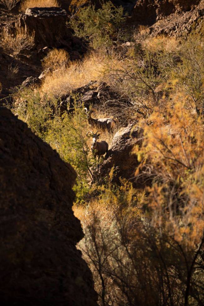
The flat water moves slowly downstream and bends around sandstone cliffs, gravelly islands and hidden coves. It carries cormorants, who move through the water in flocks, and attracts bighorn sheep, grazing near the water’s surface. One can often spot bald eagles, peregrine falcons, osprey and red-tailed hawks soaring above the river.
Climbing into a boat at the base of the dam, paddlers may find themselves in awe of the grandeur on all sides, both natural and human-made.
Relaxing waters
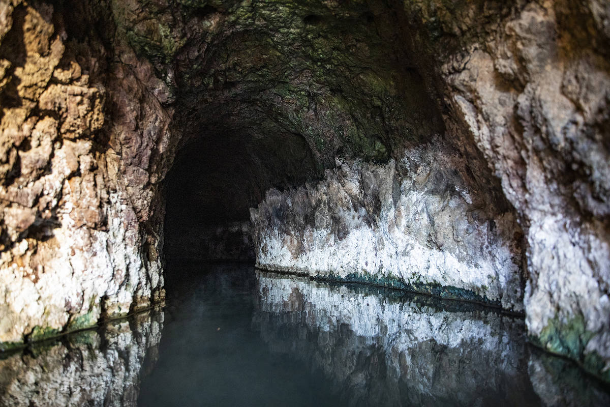
A quarter-mile downriver from the dam is a gravel spit dotted with tamarisk and creosote bushes that smell like parched earth refreshed after a first rain. Paddlers can tie up there and explore the Sauna Cave.
The shallow cave was drilled in the 1920s by workers who tunneled at the site before encountering hot, pressurized water, then abandoning it. Visitors can wade knee-deep through hot water for about 100 feet as thick, musky steam rises. As the cave narrows, explorers experience pitch-black darkness, near where it ends.
Beyond the Sauna Cave on the Nevada side of the river is Gold Strike Canyon.
The mouth of Gold Strike Canyon opens up into the river, where a steady stream of hot water floods the beach, turning the chilly river water tepid.
A short walk up the narrow canyon follows a warm brook until it reaches a pool dammed up with sandbags, fed by a waterfall that carries scalding water down from its source, imbuing the air with the pungent smell of dirt and minerals.
“We hiked in to Gold Strike Canyon yesterday. We go hiking a lot and it’s completely different out here at night,” says Ricky Gibson, picking up the empty aluminum tin from one of the tea candles he and his group had placed around the perimeter of the pool the night before.
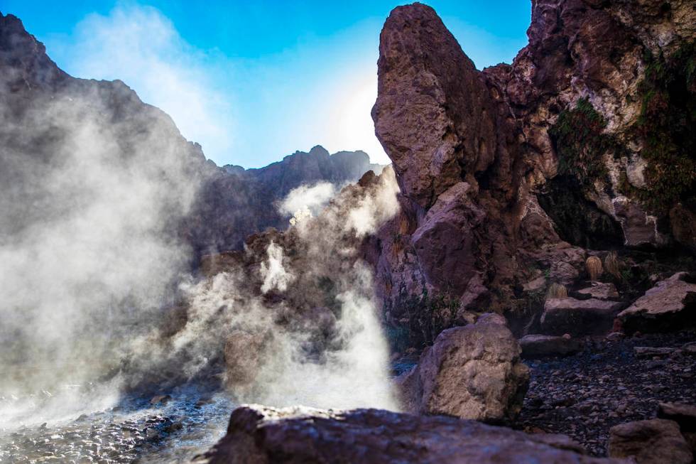
Their four colorful tents are perched between the pool and the shallow runoff, in the shade of canyon walls.
“It’s better this time of year, before it gets too crowded in the summer,” Gibson says.
Two miles down, and on the east side of the river, lies Arizona Hot Springs.
From the river, paddlers can walk uphill through a narrow slot canyon, following the sound of running water, then scramble over small boulders before reaching a clearing where a 20-foot-tall steel ladder leads to the pools.
The hot springs, divided by equal parts rock and sandbags, pour into each other and, eventually, down the ladder. As the elevation of each pool goes higher, so does their temperature.
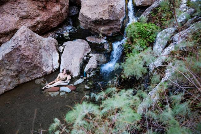
The pools, all roughly spa-sized, are shaded by marbled canyon walls that lean as they rise, forming a diamond frame to view the sky overhead.
Pinkish walls, stained white with salt and calcium deposits, and lightly sparkling where the water seeps through, echo the soft sound of water gently pouring through the canyon.
John Blackwell makes the 5.8-mile hike to the hot springs two to three days a week. The 70-year-old Las Vegan soaks in the hot water, and he says, for the past 10 years has collected litter and monitored graffiti there.
“It’s very relaxing in the hot spring,” Blackwell says. “Just the echoes of the water, being in the slot canyon. In the winter, it’s cold all over us, and this perfect spot is nice and warm.”
Blackwell often welcomes newcomers to the springs and documents his visits on his blog.
“I enjoy talking to people, and that trail gets folks from all over the place,” Blackwell says. “It’s been more busy with people out of work. I encourage people to keep it clean and respect the animals and nature there.”
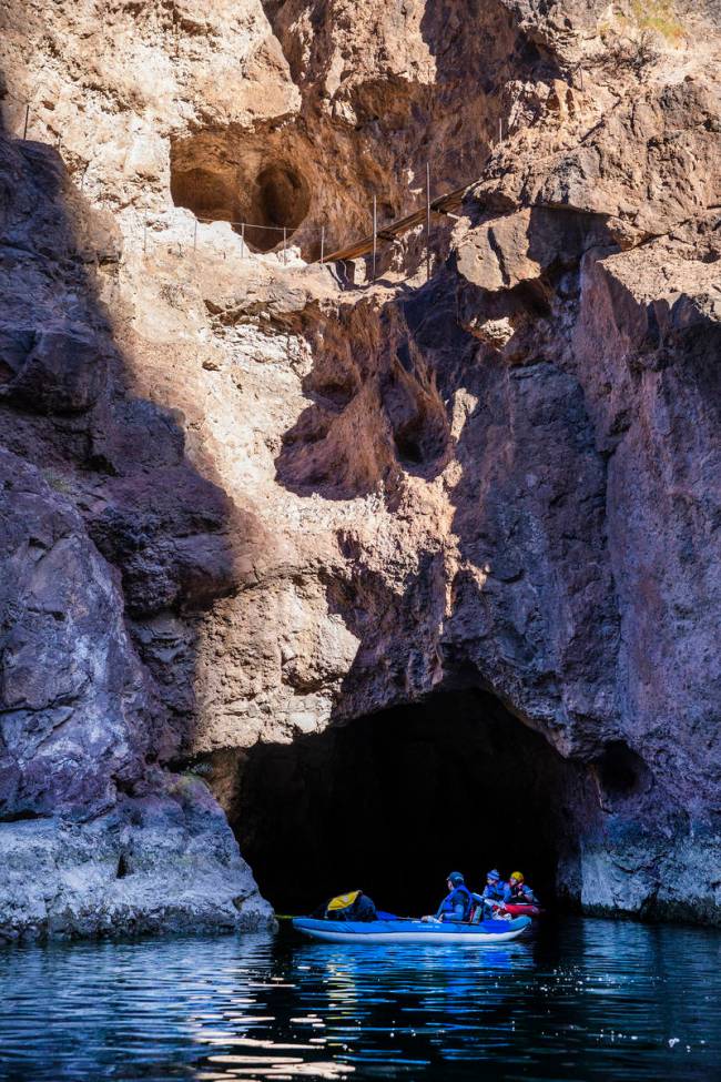
About 5 miles downriver sits the next great geologic feature of Black Canyon.
Emerald Cave is named for the phenomenon that occurs when visitors reverse into the cave when the sun is shining straight down, an effect most amplified on summer afternoons. From inside Emerald Cave, the river takes on an otherworldly hue, sparkling with a deep green that reflects kaleidoscopically across the cave’s walls.
“The romance of Emerald Cave is a natural phenomenon that is rarely duplicated. It’s an epic experience,” says Danny Latham, owner of Vegas Glass Kayaks. Latham explains that the water along the 12-mile stretch of Black Canyon is the cleanest and purest of the Colorado River, fed by filtered water weeping from the canyon’s geothermal aquifers and the deepest parts of Lake Mead.
“Starting in March, the sun comes straight down and reflects off the bottom of the river, lighting up the water from below. The light is everywhere. It turns the whole cave green and creates this disco ball (effect) on the ceiling,” Latham says.
A vestige from the ’30s
Opposite Emerald Cave, a small metal shack is affixed to the side of the cliff, with a fragile-looking ladder extending down to the river. The Willow Beach Gauging Station is a vestige from the 1930s, when engineers W.L. Heckler and W.E. Dail lived and worked in the canyon, gathering data on the flow of the Colorado River down from Boulder Dam, after its 1935 completion.
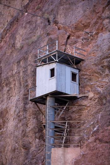
Downstream from the gauging station sits a small beach where a historic trailhead leads up to the engineers’ homesite. The remaining artifacts outline a typical day in the life of a river gauger. From the site, which used to hold a garage and a small home, the gaugers would navigate a catwalk of narrow wooden planks laid on steel supports embedded into the side of the cliff. Next, they would climb into a rickety boxcar and pull themselves across the river via a cable that extended from one side of the river to the other, leading them to the gauging station.
Today, only the retaining wall still stands at the homesite, but guests may follow the short trail up and look out over its ruins to see sweeping views of the Colorado River.
From the homesite, the last mile of the journey follows a sharp bend around cliffs on the Nevada side.
The wafting smells of charcoal barbecue and gasoline transport paddlers from the quiet rusticism of the canyon to the clamorous picnic area at Willow Beach Marina.
After passing the fish hatchery and boat moorage, paddlers may pull their canoes and kayaks up onto the sandy beach of the marina, stretch their aching arms and tired legs and watch the sun set over the sparkling surface of the Colorado River.
If you go
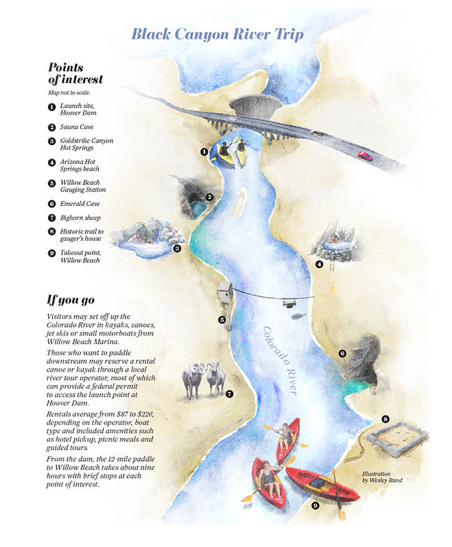
Visitors may set off up the Colorado River in kayaks, canoes, jet skis or small motorboats from Willow Beach Marina.
Those who want to paddle downstream may reserve a rental canoe or kayak through a local river tour operator, most of which can provide a federal permit to access the launch point at Hoover Dam.
Rentals average from $87 to $226, depending on the operator, boat type and included amenities such as hotel pickup, picnic meals and guided tours.
From the dam, the 12-mile paddle to Willow Beach takes about nine hours with brief stops at each point of interest.


